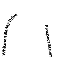
7 WHITMAN BAILEY DR
Owner Information
MERCIER RICHARD W
7 WHITMAN BAILEY DR
AUBURN, MA 01501


Property Details
7 WHITMAN BAILEY DR is classified as a Condo NL (Condominium).
The primary structure on this property was built in 2020. There are 5,743ft2 of built area within this property. There is 2,086ft2 of residential/living space within this property. This property is listed as having 6 rooms.
7 WHITMAN BAILEY DR is valued at $423,700. The land is valued at $0 and the structures are valued at $423,700.
This property is in Zone RB. Confirm with local Zoning Board authorities to ensure there are no overlays or other easements on this property.
The most recent deed for 7 WHITMAN BAILEY DR is recorded at the local registrar in Book 62489, Page 337. 7 WHITMAN BAILEY DR was last sold on Friday, May 29, 2020 for $528,562.
Assessment data from fiscal year 2022.
Flood Data
According to the FEMA National Flood Hazard Layer, this property does not appear to be in a flood zone. It may also be in an area not yet reviewed. Nonetheless, confirm this information prior to taking any action.
To view the flood hazards around this property, create a FEMA "Firmette" Map of the area around 7 WHITMAN BAILEY DR.
Broadband Internet Providers
| Provider | Type | Bandwidth (mbps) | |
|---|---|---|---|
| GCI Communication Corp. | Satellite | 0 | 0 |
| Crown Castle Fiber | Fiber | 0 | 0 |
| Viasat Inc | Satellite | 100 | 3 |
| Verizon New England Inc. | DSL | 5 | 0 |
| VSAT Systems, LLC. | Satellite | 2 | 1 |
| HughesNet | Satellite | 25 | 3 |
| Charter Communications Inc | Cable | 940 | 35 |
Broadband service provider data from December 2020.
Adjacent Properties
- 44 PROSPECT ST
Single Family Residential owned by DORAY KEVIN R - 50 PROSPECT ST
Single Family Residential owned by MUHAMMAD MUSTAFA - 52 PROSPECT ST
Single Family Residential owned by CEFFALO FRANK W - 100 PROSPECT ST
Single Family Residential owned by MARTINEAU ERIC J - 130 PROSPECT ST
Single Family Residential owned by REILLY ERIN NOELLE - 128 PROSPECT ST
Single Family Residential owned by LYNCH NICHOLAS S - 134 PROSPECT ST
Single Family Residential owned by WIGEN RUSSELL J - 136 PROSPECT ST
Two-Family Residential owned by LEONARD KEVIN F - ATHENS ST
Developable Residential Land owned by SIBLEY VIVIAN U